

Geophysical Surveying and Mapping Services
Geophysical surveying and mapping services collect seismic, magnetic, gravity, electrical and ground-penetrating radar data for clients in energy, mining, engineering and environmental sectors. Crews schedule field campaigns, deploy sensors and drones, record raw readings, process data into maps and cross-sections, and deliver interpreted reports. The specialists convert client requests into permitted survey plans, field data into organized datasets, raw readings into processed maps using industry software, and final deliverables into client-ready reports while tracking equipment, permits and landowner access.
What makes this business different
- Client-defined survey objectives that dictate sensor types, line spacing, depth targets and resolution
- Land-access permissions, right-of-way agreements, environmental permits and cultural-resource clearances before any field work
- Remote or rugged terrain requiring specialized vehicles, drones, safety protocols and seasonal weather windows
- High-volume raw geophysical data that must be backed up daily, organized by line and station, and protected from corruption
- Calibration and maintenance logs for seismographs, magnetometers, gravimeters, GPR units and drones
- Data processing that follows client or regulatory standards for filtering, migration, inversion and contouring
- Delivery of multiple products including raw files, processed grids, interpreted maps, cross-sections and written reports
- Repeat or multi-phase projects for the same client that require consistent coordinate systems, datums and previous-survey tie-ins
Specialist bots

Project Intake Specialist
Convert every client request into a scoped project task with required methods, coordinate system and deliverable list.
Works in: Ambitious Tasks, Ambitious Docs, Ambitious Sheets · Workflows: Project intake and scoping
Automates
- Reads incoming proposals and emails to extract objectives and constraints
- Creates standardized project folders and task lists
- Checks equipment and crew availability against requested timeline
- Drafts scope confirmation for owner approval
Stops for a person
- The owner reviews and approves scope, pricing and technical approach before any commitment
- Technical feasibility questions are answered by a licensed geophysicist
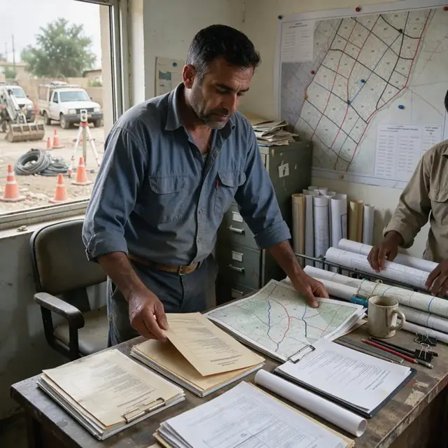
Permitting Coordinator
Prepare, submit and track all land access agreements, environmental permits and regulatory filings required before field work.
Works in: Ambitious Docs, Ambitious Tasks, Ambitious Sheets · Workflows: Permitting and access coordination
Automates
- Generates permit application templates populated with project boundaries and methods
- Maintains a master calendar of submission and expiration dates
- Compiles supporting documents such as cultural resource reports and safety plans
- Updates status dashboard as agencies respond
Stops for a person
- The owner confirms accuracy of legal descriptions and technical method statements
- All final submissions and negotiations with agencies or landowners are performed by people

Field Operations Dispatcher
Assign crews and equipment to survey blocks, generate daily line plans and monitor mobilization status.
Works in: Ambitious Tasks, Ambitious Sheets · Workflows: Field crew scheduling and mobilization
Automates
- Builds daily and weekly crew schedules based on permit status and weather
- Creates line-by-line navigation files for data loggers
- Generates pre-deployment checklists for each sensor type
- Sends daily field briefs once the owner approves
Stops for a person
- Crew leads and the owner approve final daily plans and safety briefings
- Any changes to survey design while in the field must be authorized by the project geophysicist

Data QC Analyst
Ingest daily raw geophysical data, run quality control checks and flag lines requiring re-acquisition.
Works in: Ambitious Tasks, Ambitious Sheets, Process Optimizer · Workflows: Data acquisition and daily QC
Automates
- Imports raw files and verifies station count, timing and positioning
- Runs scripts for noise, signal strength and coverage metrics
- Highlights data gaps or instrument drift on a master log
- Creates backup copies and updates the acquisition tracking sheet
Stops for a person
- The project geophysicist reviews all flagged lines and decides on re-shooting
- Final data acceptance is signed off by the owner or client representative

Geophysical Data Processor
Process raw geophysical readings into filtered grids, migrated sections and interpreted maps following client specifications.
Works in: Ambitious Docs, Ambitious Sheets, Process Optimizer · Workflows: Data processing and mapping
Automates
- Applies standard filtering, static corrections and gridding routines
- Generates contour maps, depth slices and cross-section plots
- Produces processing logs that document every parameter used
- Organizes intermediate and final data products into client-ready folders
Stops for a person
- A licensed geophysicist selects processing parameters and validates the final interpretation
- The owner reviews all deliverables before they are sent to the client

Report Compiler
Assemble processed data products, interpretation notes and client requirements into a complete, organized final report package.
Works in: Ambitious Docs, Ambitious Tasks, Ambitious Sheets · Workflows: Report compilation and delivery
Automates
- Populates report templates with maps, tables and standard methodology text
- Compiles digital archive containing every raw, processed and interpreted file
- Generates transmittal letters listing all deliverables
- Prepares draft reports for review
Stops for a person
- The owner or lead geophysicist writes and approves all interpretive conclusions
- Every report and data package is reviewed and approved by a person before delivery

Equipment and Calibration Manager
Maintain calibration records, usage logs and maintenance schedules for all geophysical sensors, drones and vehicles.
Works in: Ambitious Sheets, Ambitious Tasks, Ambitious Docs · Workflows: Equipment maintenance and inventory
Automates
- Tracks calibration due dates and test results for each instrument
- Monitors battery cycles, cable wear and drone flight hours
- Generates monthly readiness reports and replacement forecasts
- Maintains digital service and maintenance logs
Stops for a person
- The owner approves all repair expenditures and new equipment purchases
- Certified technicians perform and document actual calibration and repairs
Workflows
Project intake and scoping
Starts when: A new client inquiry or signed proposal arrives
- Extract survey objectives, location, size, required methods and deliverables from the request
- Check against equipment availability, crew schedules and seasonal constraints
- Draft a project task with line-kilometer estimates, sensor list and timeline
- Create a master folder structure for raw data, processed files and reports
- Send a confirmation of scope and next steps for approval
Watch for: Exact coordinate system, datum and projection must be captured and never assumed; Any regulatory or landowner restrictions must be flagged immediately
Permitting and access coordination
Starts when: After project scope is confirmed and before mobilization
- Identify required federal, state and local permits plus landowner notifications
- Draft permit applications and access agreements with project boundaries and methods
- Track submission dates, agency comments and expiration timelines
- Compile cultural, environmental and safety clearance documents
- Maintain a master permit status sheet updated daily until all approvals are secured
Watch for: Some permits require public notice periods or archaeological surveys before approval; Landowner contact preferences and seasonal restrictions must be respected
Field crew scheduling and mobilization
Starts when: All permits are received and weather window opens
- Assign crew, vehicles and equipment to the survey block
- Generate daily field plan with line numbers, station intervals and sensor configurations
- Load navigation and data-logger programs with the approved grid
- Perform pre-deployment equipment checks and calibration
- Send daily safety and access briefing to the field team
Watch for: Crew must confirm landowner contact before entering private property each day; Equipment must be tested for drift and noise before each line
Data acquisition and daily QC
Starts when: Field crew begins line collection each day
- Monitor incoming raw data files by line and station
- Run automated QC checks for gaps, spikes, signal-to-noise and positioning accuracy
- Flag lines needing re-acquisition or infill
- Securely back up each day's raw files to multiple locations
- Update the master acquisition log with line status and notes
Watch for: Data volumes can reach many gigabytes per day and must never be lost; Positioning must tie to survey benchmarks or real-time kinematic corrections
Data processing and mapping
Starts when: A complete survey block or line set is acquired and backed up
- Import raw data into processing software and apply client-specified filters
- Perform static corrections, velocity analysis, migration or inversion as required
- Generate gridded maps, contour plots and cross-sections
- Produce interpreted products such as depth slices or anomaly reports
- Package all intermediate and final files with processing logs
Watch for: Processing parameters must exactly match client or regulatory requirements; Previous survey data must be reprojected and tied for consistent interpretation
Report compilation and delivery
Starts when: Processed data and interpretations are ready for client review
- Assemble report sections including methodology, data quality, maps, cross-sections and conclusions
- Draft executive summary and recommendations based on the interpreted results
- Compile all digital deliverables into an organized archive
- Create a transmittal letter listing every file and its purpose
- Send draft package for final review before release
Watch for: Final coordinate system and datum must appear on every map and in every file header; Sensitive client data must be transferred through approved secure channels only
Equipment maintenance and inventory
Starts when: After each deployment and on a monthly cadence
- Log calibration results, battery status and sensor health for every unit
- Schedule repairs or factory service when drift or noise exceeds tolerances
- Track consumables such as cables, geophones, batteries and drone parts
- Update the master equipment inventory sheet with location and readiness status
- Forecast replacement needs based on usage hours and project backlog
Watch for: Certain sensors require annual factory recalibration to maintain data integrity; Drone batteries and firmware must comply with current flight regulations
Bot templates for this industry
Source: U.S. Small Business Administration, Office of Size Standards, Table of Small Business Size Standards Matched to North American Industry Classification System Codes, version March 2023 (effective 2023-03-17, NAICS 2022). Size standards are shown for reference only.